- Module/Course coordinator: Seleshi Yalew
- Module/Course coordinator: Hans Kwast, van der

- Module/Course coordinator: Hans Kwast, van der


- Module/Course coordinator: Sara Masia

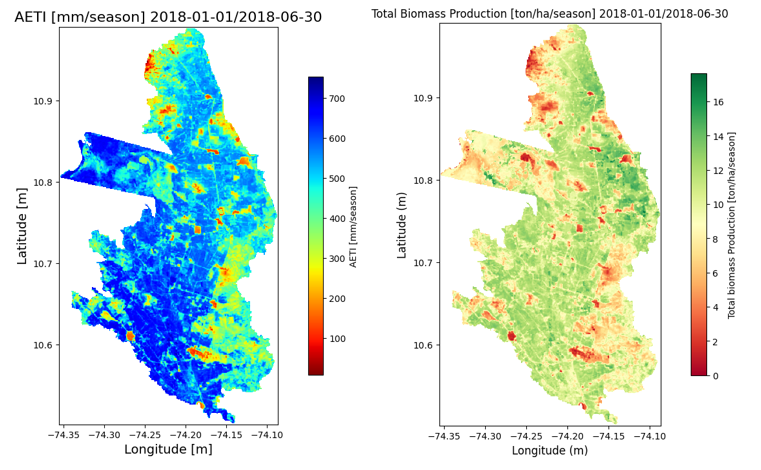
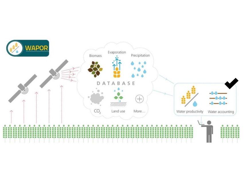
OpenCourseWare of pyWaPOR, an algorithm for developing high resolution WaPOR data for your own Area of Interest. Interested in being trained on this topic?
Our next course is taking place in March 2025. Fellowships from the MENA Scholarships Programme are available. More information here. Our course on 'Python for Geospatial applications using WaPOR data' is a pre-requisite.
If you would like to explore opportunities for a group training on this or other topics from our team contact us by sending us an email: TrainingAndAdvisoryService@un-ihe.org
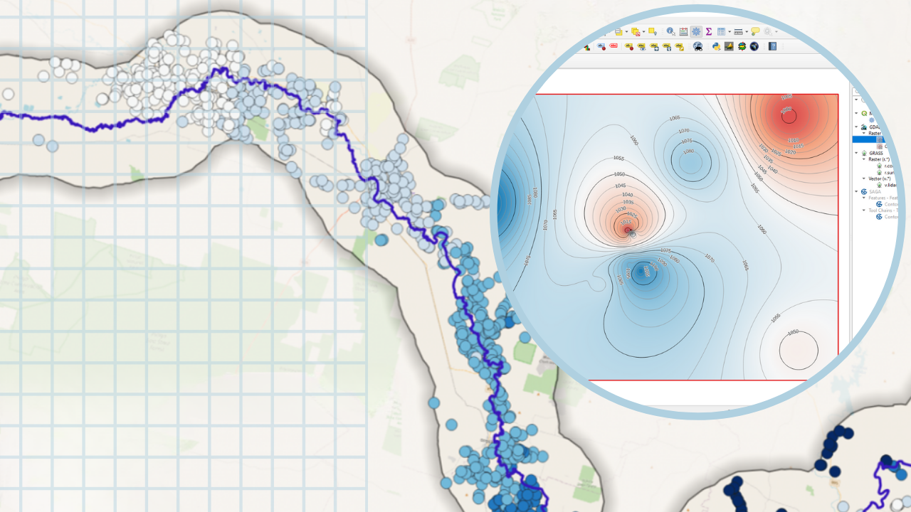
Learn QGIS for hydrological applications, recipes for catchment hydrology and water management.
- Module/Course coordinator: Hans Kwast, van der

Learn QGIS for hydrological applications, recipes for catchment hydrology and water management.
- Module/Course coordinator: Hans Kwast, van der


QGIS for Hydrological Applications

Klimaatbestendig handelen voor én door professionals
- Module/Course coordinator: Berry Gersonius